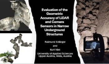
Accurate 3D mapping of narrow underground structures is critical for tunnel inspection, mining, and subsurface exploration applications. This study evaluates the geometric accuracy of different LiDAR and camera-based sensors in confined environments (Erdstall facilities). We compare the performance of a high-precision terrestrial LiDAR scanner (Leica BLK360), a smartphone LiDAR system (iPhone 15 Pro Max), and an RGB-depth sensor-based device (Lenovo Phab 2 Pro with Google Tango technology). The field experiments and evaluation are based on the quality of the point cloud, the spatial consistency, and the measurement deviations. The handling of the measuring devices used and the measurement duration are also considered. The results indicate that, while both sensors have unique strengths, LiDAR demonstrates superior performance in capturing detailed measurements and achieving higher point density, particularly in challenging lighting conditions. In contrast, camera sensors excel in texture and color fidelity, providing rich visual information that aids interpretation. However, the handheld device has significant advantages in handling and measurement duration and is far superior to the terrestrial scanners in these narrow underground structures.

Vehicle re-identification (re-ID) is based on identity matching of vehicles across non-overlapping camera views. Recently, the research on vehicle re-ID attracts increased attention, mainly due to its prominent industrial applications, such as post-crime analysis, traffic flow analysis, and wide-area vehicle tracking. However, despite the increased interest, the problem remains to be challenging. One of the most significant difficulties of vehicle re-ID is the large viewpoint variations due to non-standardized camera placements. In this study, to improve re-ID robustness against viewpoint variations while preserving algorithm efficiency, we exploit the use of vehicle orientation information. First, we analyze and benchmark various deep learning architectures in terms of performance, memory use, and cost on applicability to orientation classification. Secondly, the extracted orientation information is utilized to improve the vehicle re-ID task. For this, we propose a viewpoint-aware multi-branch network that improves the vehicle re-ID performance without increasing the forward inference time. Third, we introduce a viewpoint-aware mini-batching approach which yields improved training and higher re-ID performance. The experiments show an increase of 4.0% mAP and 4.4% rank-1 score on the popular VeRi dataset with the proposed mini-batching strategy, and overall, an increase of 2.2% mAP and 3.8% rank-1 score compared to the ResNet-50 baseline.

Event cameras—which detect pixelized, spatiotemporal changes asynchronously as opposed to frame-based triggered cameras—are commercially available and the topic of considerable research recently for computer vision and robotics applications. We hypothesize that these novel devices can be of utility in understanding mechanical motion by performing functions similar to high speed cameras, but with reduced bandwidth and simpler processing. To test this hypothesis, we applied multiple measurement modalities to a simple high-speed mechanical tool, including accelerometer, acoustic, and event-camera images. We also explore the utility of onboard inertial measurement units which are often integrated into these devices. Our analysis shows that these measurements are possible and consistent across modalities, possibly leading to novel new architectures for image and sensor based measurements.

Measuring vehicle locations relative to a driver's vehicle is a critical component in the analysis of driving data from both postanalysis (such as in naturalistic driving studies) or in autonomous vehicle navigation. In this work we describe a method to estimate vehicle positions from a forward-looking video camera using intrinsic camera calibration, estimates of extrinsic parameters, and a convolutional neural network trained to detect and locate vehicles in video data. We compare the measurements we achieve with this method with ground truth and with radar data available from a naturalistic driving study. We identify regions where video is preferred, where radar is preferred, and explore trade-offs between the two methods in regions where the preference is more ambiguous. We describe applications of these measurements for transportation analysis.