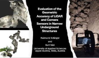
Accurate 3D mapping of narrow underground structures is critical for tunnel inspection, mining, and subsurface exploration applications. This study evaluates the geometric accuracy of different LiDAR and camera-based sensors in confined environments (Erdstall facilities). We compare the performance of a high-precision terrestrial LiDAR scanner (Leica BLK360), a smartphone LiDAR system (iPhone 15 Pro Max), and an RGB-depth sensor-based device (Lenovo Phab 2 Pro with Google Tango technology). The field experiments and evaluation are based on the quality of the point cloud, the spatial consistency, and the measurement deviations. The handling of the measuring devices used and the measurement duration are also considered. The results indicate that, while both sensors have unique strengths, LiDAR demonstrates superior performance in capturing detailed measurements and achieving higher point density, particularly in challenging lighting conditions. In contrast, camera sensors excel in texture and color fidelity, providing rich visual information that aids interpretation. However, the handheld device has significant advantages in handling and measurement duration and is far superior to the terrestrial scanners in these narrow underground structures.