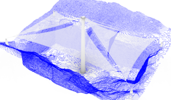
This paper presents a space-efficient alternative for visualizing 3D data; it utilizes topographical maps to allow easier editing and viewing of 3D models. It highlights applications in generating progressive level of detail (LODs) and offers a straightforward way to generate preview models that allow users interaction. This offers a geometrically-accurate model compared to more commonly used representations for such tasks (e.g. point clouds). The topographical model is achieved using incremental slicing in each of the dimensions resulting in a lighter, more uniform shape. In our testing, we observed an improved 35.4% in memory usage, 7 times faster rendering time, and 82.4% in space savings on average compared to mesh, wireframe, and point cloud. We also provide a browser-based demo that exports standard GLB files.